In the suburbs that hug the Hawkesbury River in Sydney’s north west, some residents are lost for words about the latest floods. To locals anxiously watching water swallow bridges, roads, houses and entire suburbs for the third time this year, it feels relentless.
“What more is there to say really?” asks 35-year-old mother Tracey, who has lived in the Hawkesbury her whole life. While recalling all the floods that have occurred over the past two years, she momentarily loses count.
Following days of harrowing emergency boat rescues, one drowning death, and 50,000 people either ordered or warned to evacuate their homes across New South Wales, Tracey says she is lucky.
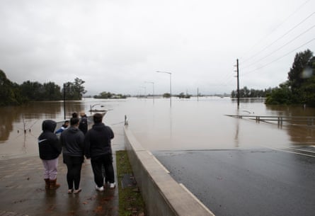
While some parts of Windsor in Sydney’s north-west were ordered to evacuate by 11.30am on Tuesday, Tracey is one of the handful of those living on higher ground who have descended on the suburb to observe the bridge over the Hawkesbury drowning in more than 14 metres of water.
Many stand in their raincoats in silence, some discuss what a struggle the rebuild will be, while others talk of the relief to still have a house.

Tracey stands with her young son looking at a pole above the Windsor Bridge marking historic flood events. The frequency has been such that two events earlier this year are yet to be inscribed.
The bridge has become somewhat of a hallmark of media coverage of the Hawkesbury flooding, with its steep incline into town providing an ideal spot for TV reporters wanting visible flooding in the backdrops of their live crosses.
While locals and TV reporters are out at the bridge on Tuesday, there is an eerie feeling throughout the rest of Windsor.
Just to access the suburb requires a series of detours, and though meteorologists say the heavier rainfalls have passed, there is a constant drizzle that means few linger on the cold, windy streets.

Almost all businesses and cafes in town, while open, are empty. Jazz blasting inside the patronless Delicious Desserts parlour echoes down the main pedestrian mall on George Street, as locals walk past into supermarkets and bottle shops to stock up on supplies.
In recent years Tracey moved with her family to a nearby estate, partly because of its placement on higher ground. It’s built on a swamp that has been concreted over, like many of the new suburbs on the floodplain, but Tracey’s home will not flood unless waters reach 17 metres.
Their suburb has not been ordered to evacuate, and that higher flood limit gives her some comfort. She acknowledges it is the surge in development and construction of housing estates on swampland that has made the terrain in this part of Sydney less able to absorb rain runoff.
“They just shouldn’t have built houses here, I mean it’s a floodplain. What else can they do now to make it better?”
Asked if she would ever consider moving away from the Hawkesbury if the frequency of floods increased, she says she doubts she could afford another home elsewhere in Sydney.
Windsor's Flood History, at Windsor Bridge @GuardianAus pic.twitter.com/pVi7rOBgYe
— Elias Visontay (@EliasVisontay) July 5, 2022
Her main concern is the possibility of waters rising to cut off access to supplies – and an exit route.
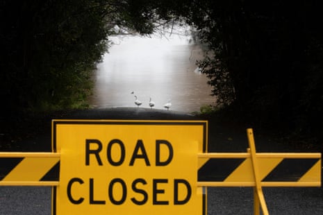
The closure of key roads across the city’s west is making life difficult for those who have not had to evacuate, as well as emergency workers and business owners travelling into the area.
Routes into and around north west Sydney are are submerged. On the roads that are still open, potholes and other damage are already creating havoc for drivers.
At one road closure in Richmond, tradesmen discuss the almost three-hour drive they will have to take to return home to Wilberforce, 10km away as the crow flies.


